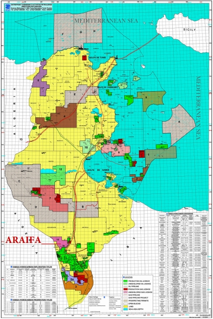
The Araifa Exploration Permit Area is located in southern Tunisia within the hydrocarbon-rich Ghadames Basin. The Permit lies north of the El Borma field—Tunisia’s largest oil field, discovered in 1965—and west of the Jebel Grouz field, discovered in 1981. Existing oil and gas export pipelines originating from El Borma traverse the southeastern section of the Araifa Permit Area, ensuring proximity to strategic infrastructure.
YNG Exploration Limited is the designated Operator of the Araifa Exploration Permit under a Convention executed with the Republic of Tunisia, represented by ETAP (Entreprise Tunisienne d’Activités Pétrolières), the national oil company. The Exploration License entered into force following its publication in the Official Bulletin of the Republic of Tunisia No. 103 on 27 December 2013.
Work Program
The approved exploration program for Araifa includes:
- Geological and geophysical studies
- Satellite imagery acquisition, processing, and interpretation
- Acquisition, processing, and interpretation of 655 km² of 3D seismic
- Drilling of two (2) exploration wells.
Seismic Acquisition
Field seismic operations commenced on 4 April 2016, covering a 655 km² 3D seismic survey. Data acquisition and recording were completed on 3 August 2017. GeoSeis Service acted as the seismic contractor for this campaign.
Exploration Wells
- Araifa-1: Drilled and completed in March 2022. The well tested successfully, delivering 150,000 Sm³/d of gas and 730 bbl/d of condensate.
- Araifa-2: Drilled and completed in March 2023, followed by well testing.
Development Status
A long-term production test (LTT) on the Araifa discovery commenced in May 2025, marking a key milestone in the appraisal and commercialization phase of the project.
ARAIFA Permit Overview
| Name | Araifa | |
| Classification | Exploration Permit | |
| Location | Southern Tunisia | |
| Association Contract | YNG Exploration LimitedBur. B-1.3 Immeuble Lac de Constance, Rue du Lac de Constance, Les Berges du Lac - 1053 Tunis, Tunisia Phone: +216 71 963 043 Fax: +216 71 963 044 | |
| Operator | 50% | |
| ETAP | 50% | |
| Surface Area | 1012 km² | |
| Effective Date | December 27, 2013 | |
| JORT N°103 of December 27, 2013 | ||
| Validity Extension: December 26, 2025 | ||
Exploration Permit Initial Period (5 + 2 years: Dec. 2013 - Dec. 2020) In December 2020, the license was renewed for 1 year due to force majeure - the Covid-19 pandemic until December 2021 In December 2021, a 1-year license renewal was received as part of the second license renewal until December 2022 | Exploration Permit 1st Renewal (3 years) In December 2022, the License was renewed for 3 years until December 26, 2025 | Exploration Permit 2nd Renewal (3 years) Commitment | |
|---|---|---|---|
| Commitment |
|
|
|
| Work performed |
Infrastructure and Ongoing Activities
|


