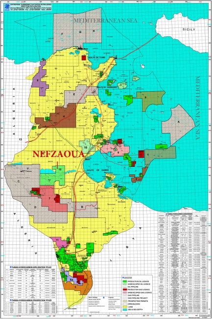
The Nefzaoua Exploration Permit is located in central Tunisia within Kebili and Gabes Province and forms part of the Chott oil and gas basin. The Permit covers 3,132 km² and lies in proximity to several established hydrocarbon fields, including El Franig, Sabria, Ghrib, Baguel, El Bibane, Ezzaouia, and Robbana. Existing oil and gas pipeline infrastructure is located within approximately 15 km of the Permit boundary, while the export terminals of Gabès and La Skhira on the Mediterranean coast are situated 60–70 km from the Permit Area.
YNG Energy Limited is the designated Operator of the Nefzaoua Exploration Permit under a Convention with the Republic of Tunisia, and ETAP (Entreprise Tunisienne d’Activités Pétrolières). The Exploration License entered into force upon its publication in the Official Gazette of the Republic of Tunisia No. 102 on 22 December 2017.
Work Program
The approved exploration program for Nefzaoua comprises:
- G&G studies.
- 2D Seismic reprocessing.
- Purchase of 236 sq. km of 2008 3D seismic.
- Acquisition of 300 Sq Km of 3D or equivalent of 2D seismic data.
- 01 Exploration well (minimum TD=3650m).
Completed Activities (2017–2025)
- 2019–2025: Full technical review and integrated analysis of geological and geophysical datasets.
- June–December 2019: Reprocessing of 24 seismic profiles totaling 714 linear km.
- January–August 2020: Reprocessing of 236 km² of 3D seismic data.
- Drilling the exploration well is planned for early 2026.
Nefzaoua Permit Overview
| Name | Nefzaoua | ||
| Classification | Exploration Permit | ||
| Location | Central Tunisia | ||
| Association Contract | YNG Exploration LimitedBur. A-1.2 Immeuble Lac de Constance, Rue du Lac de Constance, Les Berges du Lac - 1053 Tunis, Tunisia Phone: +216 71 963 043 Fax: +216 71 963 044 | ||
| Operator | 50% | ||
| ETAP | 50% | ||
Surface Area Effective Date: | 3132 km² December 22, 2017 | ||
| JORT N°102 of December 22, 2017 | |||
| Expired Initial Period: December 21, 2023 | |||
The Initial Period of the Nefzaoua Exploration Permit covers five (5) years, running from 22 December 2017 to 21 December 2022.
| Exploration Permit 1st Renewal (3 years) | Exploration Permit 2nd Renewal (3 years) | |
|---|---|---|---|
| Commitment |
|
|
|
| Work Performed |
|


